

Files
Description
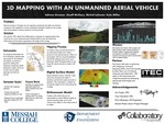
Missionary aviation pilots often have to land their planes on remote airstrips that might be unsafe due to runway obstructions such as encroaching vegetation or large objects that were unknowingly placed on the runway. The Falcon Unmanned Aerial Vehicle (UAV) team is partnering with ITEC to develop an imaging system using a UAV to scan these airstrips to detect these obstructions. ITEC was founded by Steve Saint, the son of martyred missionary Nate Saint, to develop technologies to aid missionaries in their work. This video highlights the work of the Falcon UAV team and the basic terms and definitions for understanding the work of the team. The Falcon UAV team focuses primarily on the use of automated 3D mapping and photogrammetry by drones to help identify obstructions to pilots landing on remote airstrips. In this video, we will explore 3D mapping and compare different options for drones to purchase and software to use in the process of mapping information.
Publication Date
2020
Keywords
undergraduate research, collaboratory, college, university, innovation, global, improvement, messiah college, messiah university
Disciplines
Agricultural and Resource Economics | Development Studies | Engineering | Nonprofit Administration and Management | Urban Studies and Planning
Recommended Citation
Greaser, Johnny; Lehman, Micah D.; McClary, Geoffrey D.; and Miller, Kyle E., "3D Mapping with an Unmanned Aerial Vehicle" (2020). 2020 Collaboratory/Engineering Symposium. 15.
https://mosaic.messiah.edu/engr2020/15
Included in
Agricultural and Resource Economics Commons, Development Studies Commons, Engineering Commons, Nonprofit Administration and Management Commons, Urban Studies and Planning Commons